
I’ve been pretty frequently checking snowpack levels in the San Juans since November. On the Continental Divide Trail you first start to hit that high elevation snowpack around mile 750, after Cuba, New Mexico, and those snow-covered high elevations persist until around Lake City, mile 1000.
Not every year is particularly snowy, though. Some friends of mine hiked the CDT in 2018, and they barely dealt with any snow, because the snowpack was very low that year. But, a low snow year means an intense fire season a few months later when everything has thawed and dried out. So how do you check what the snowpack is to know what you’re in for on a thru-hike?
I mostly use postholer.com to check snowpack specific to the CDT, and the National Resource Conservation Service’s SNOTEL for more general Colorado snowpack information. Postholer is hyper-focused on specific hiking trails, like the CDT (and PCT, AT, etc.), while SNOTEL provides an understanding of entire watershed regions that the CDT travels through.
Here are the most useful pieces of information from postholer:
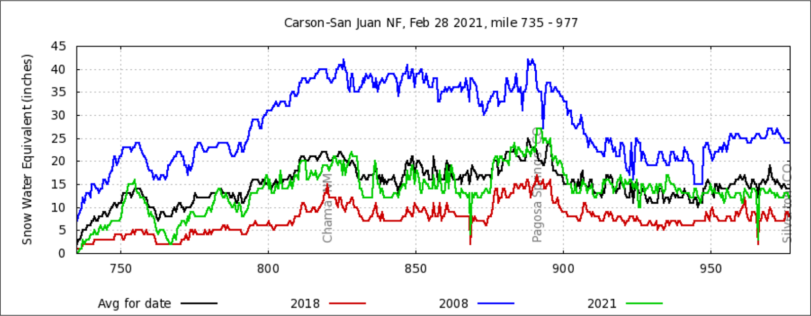
This chart shows the actual snowpack by mileage on the CDT. Pretty much everywhere along the trail is tracking just below average, so we can expect the snowpack to be pretty average come June, when the thru-hikers will start arriving at the San Juans.
The following chart is good for getting an understanding of how long the snow will stick around for:
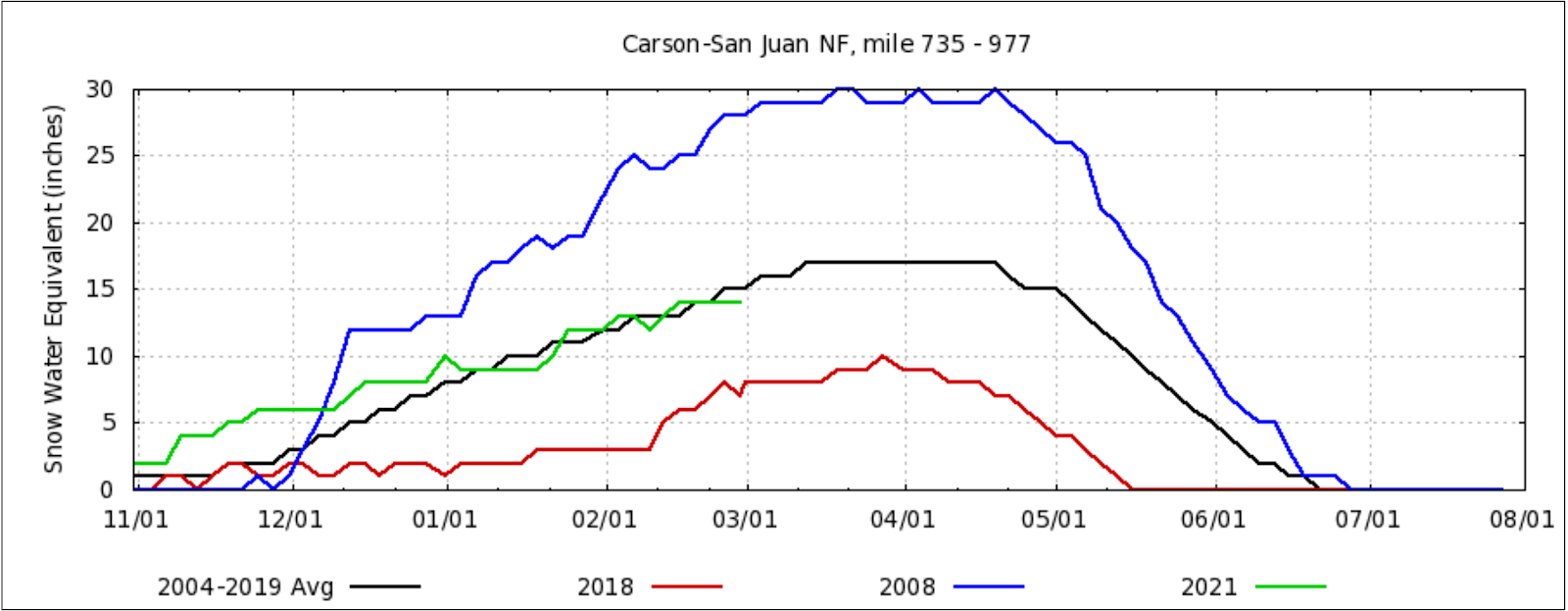
As you can see, by June 1st there is still some snow on an average year, but about 70% of the melt off has already happened. This means that the majority of the trail should be passable by June, but you will still see significant snow at the higher elevations until July.
Postholer also has the equivalent charts for those plotting a Southbound CDT trip:
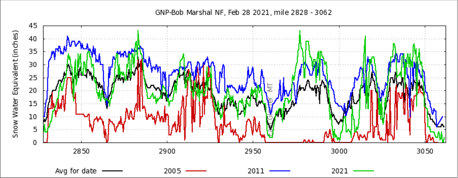
By the middle of June you can expect the majority of the melt off to have happened in what are the first 200 miles of a Southbound CDT thru-hike. Of course, like in the San Juans, there will be snow at the highest elevations persisting until July on an average year, or much longer in an above average year.
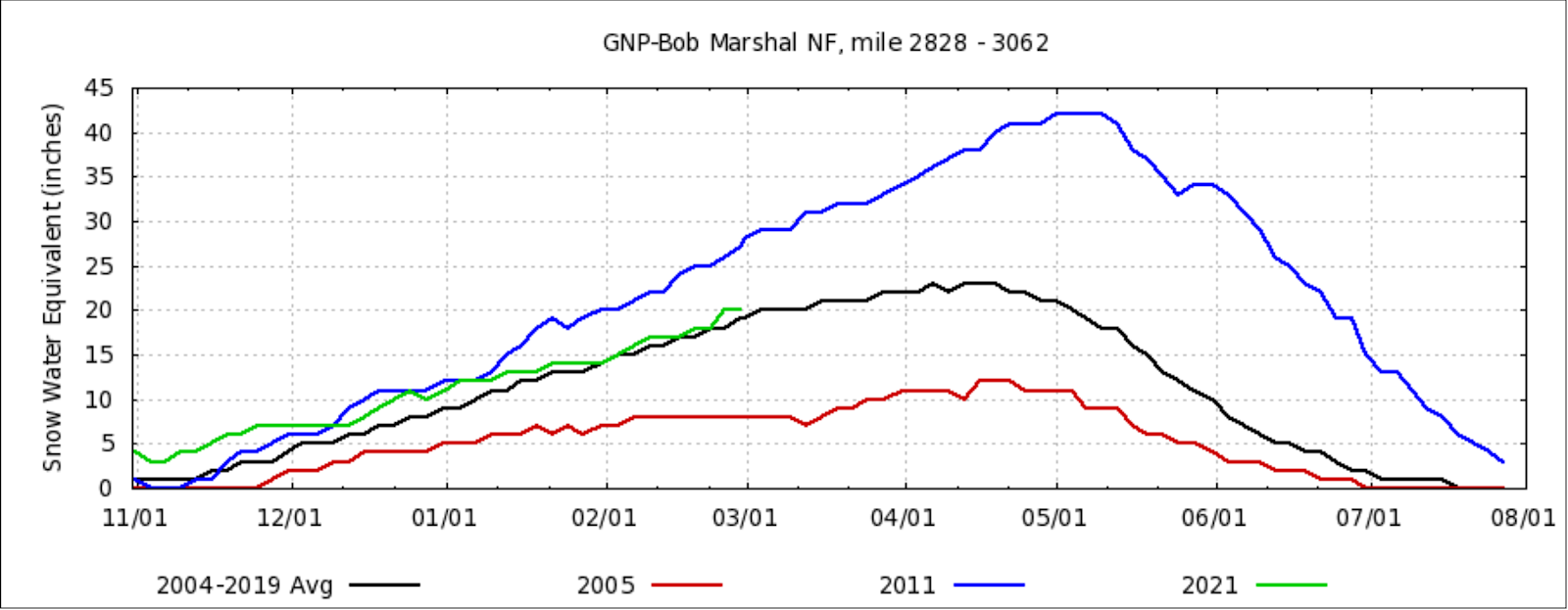
Here’s the mile by mile snowpack from Postholer:
In some areas near the Canadian border, snowpack is currently the highest it’s been in some time, so maybe pushing a Sobo start date back would be wise: to the end of June or beginning of July, instead of the middle of June. (You then run into the challenge of making it to New Mexico by when the snow starts to fall in the San Juans, in the middle to the end of September usually. One should definitely aim to be through Colorado by the beginning of October, though.)
The NRCS’s website is useful too, because thru-hiking does not exist in a vacuum. You should have an understanding of the greater environmental context that you are hiking through. This will be useful on your thru-hike. What is perhaps most useful on the SNOTEL charts is the ability to compare different snow years:
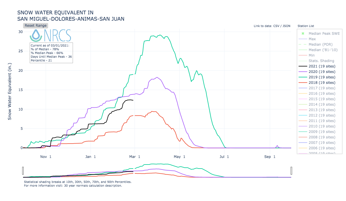
Now I’m able to compare this year’s snowpack with the previous three winters. This is useful because if you’ve been to a specific area at a known time in a previous year, you can deduce what that area will be like this year at the same time.
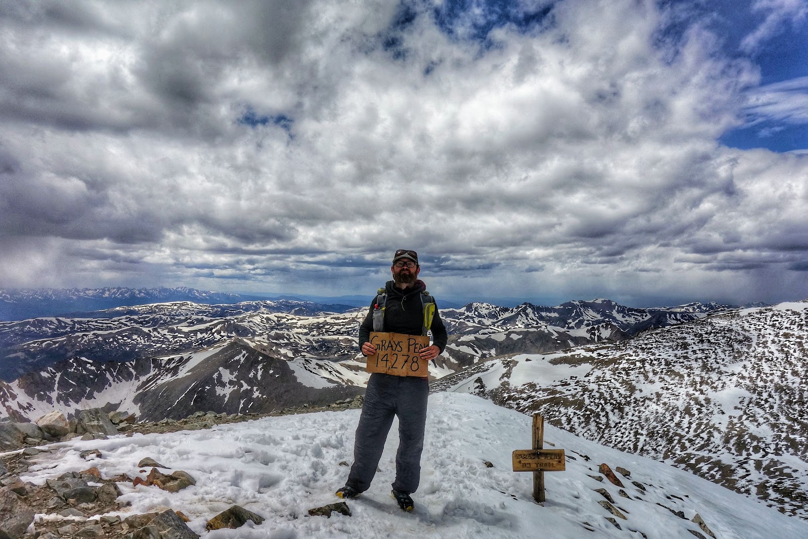
For instance, I know that last year, on June 21st (2020), I hiked to Grays Peak without using the microspikes and ice axe I brought.
But, on June 12, 2020, about 1 week before then, I struggled to get to the top of the Devil’s Thumb trail in Indian Peaks Wilderness, where it intersects with CDT mile 1300, without microspikes and an ice axe. Before getting to the top of that trail there was a lot of postholing, too. I can chart the 2020 snow levels and compare them with the current snowpack, to get an idea of when I’ll be able to hike in those areas.
I had to navigate to a different river basin, but from this I can see that this year’s snowpack in the South Platte river basin, the Colorado Front Range area, is much lower than it was in 2020:

Maybe I can hike up to the CDT via the Devil’s Thumb trail in mid June of this year. It could be a good warm up for a CDT Southbound hike.
Context for your hike is important. Even if the snowpack is low in one area specific to where you are hiking through, it could be very high somewhere else nearby, causing that river crossing to be more dangerous. Or, if the snowpack is low everywhere in Colorado, Idaho, and Montana, you can expect that the wildfires will be bad, all the seasonal streams will be dry, and most importantly, droughts are a bad sign for the environment as a whole.
Happy Hiking!
