
The best thing that could have happened to me on the Pacific Crest Trail was exactly what happened. It reinforced the need to be flexible on a long-distance adventure. I know this is supposed to be about the CDT. It still is, don’t worry.

The PCT is 2600 miles long, but you start to hit the high elevations about 750 miles north of the US-Mexico border. I hiked the PCT in 2019. After starting from Mexico on April 20th, I got to that high elevation section, the Sierra Nevada mountains (or just “the Sierras” as thru-hikers refer to them), in very early June.
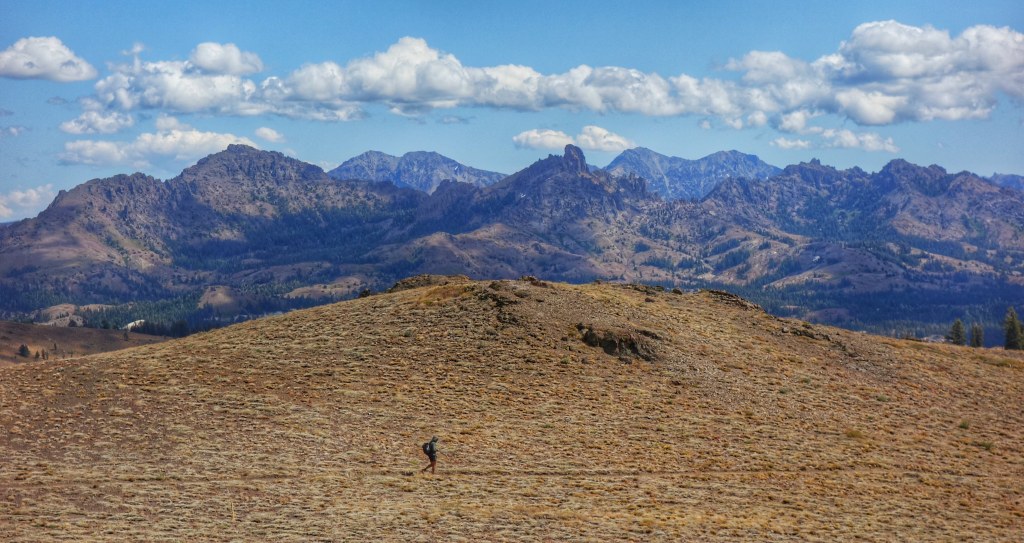
Here I am, at Kennedy Meadows, the last stop on the PCT before the Sierras on June 6th.

Just after this point, the desert starts to climb and gives way to a mountain landscape. I saw a rattlesnake halfway up the first climb. Thirty minutes later I saw snow.
But, a late May snowstorm had just hit the Sierras, adding to the already high snowpack that was just starting to melt off for the summer. Whatever, most PCT thru-hikers deal with snow in the Sierras, right? Well, sort of.
A lot of PCT hikers end up missing the worst of the snow. In recent years, snowpack has been low in the Sierras. You know the drought in California? That’s mostly a lack of snowpack in the Sierras. This has allowed many hikers to hike through the Sierras in June without too much of this.

Here at 10,000, the snow wasn’t too deep, just a couple of feet. Fortunately, it was pretty iced over here so we could walk across it, too. I can handle snow, but did I want to? Well, not really, but I was there, so I was dealing with it.
But, the wet shoes. And, the rivers of runoff everywhere. Whenever we weren’t walking over snow, we were walking through streams of melt snow. Sometimes they weren’t even streams, but rivers of melted snow, where a trail should be.

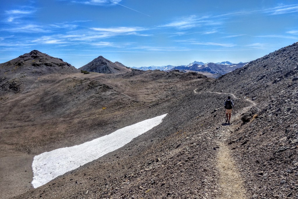
I could deal with this for at least 200 miles, or skip around it. Or, I could hitchhike north to the Canadian border and hike the PCT southbound. Then I would be getting to the highest elevation part of the trail in September. In September, the Sierras look like this.
Sign me up! So a friend and I hitch-hiked to Canada. We caught a ride out of Seattle with another friend, who drove us to the PCT near the Canadian border. We were southbounders now, goodbye snow.
It wasn’t all snow-free frolicking through fields of freshly bloomed wildflowers. But, we did get to avoid the 10,000+ elevation areas when they are snowiest. And, other than the first few weeks hiking through Washington in late June and July, we had awesome weather the whole way going south.
The CDT mirrors the PCT in many ways. It’s on the same continent, so why wouldn’t it? The highest mountains are about 800 miles north of the Mexico border. And, the coldest, wettest part of a thru-hike is near the Canadian border, especially in late summer and fall. I’ll skip the cold and wet if I can. So, southbound it is!
I’m hoping that my CDT thru-hike works out as well as my PCT hike did. My PCT hike started to make a lot more sense once I had decided to switch to southbound. So, I’m skipping the northbound part of the CDT.
I’m missing out on the desert in the spring. I’m missing out on starting my hike earlier, like now. But, I’ve already gone on a few shorter adventures in the desert this spring. I’ll be crossing the desert this fall now, something I’ve never done and am looking forward to.
I won’t be a part of the mad rush to hike north in early fall, too. Who actually wants to backpack in the direction of the oncoming winter in fall? I know what happens in northern Montana in late September. It’s not dry, and it’s not warm. It seems like the final push of a northbound thru-hike is always a mad rush to finish.
Southbounding the CDT I’ll only have to rush to get through the San Juans in southern Colorado by September. Then I’ll be in New Mexico, with all the highest elevation behind me and the desert ahead of me.

Awesome!!!! Enjoy 😊
LikeLike