
It started out rainy, turned snowy, then it got sunny and I lost my sunglasses. Then, it all melted.
Wait, I lost my sunglasses before the sun was bouncing off all that fresh snow, but does the order of events really matter? Maybe a little.
Well, I spent two days hitchhiking from Denver back to where I had left off on the CDT, just north of the Wind River Range. I lost my sunglasses running to the first car that stopped for me on a long stretch of hot, dry highway halfway between Lander and Dubois, Wyoming.
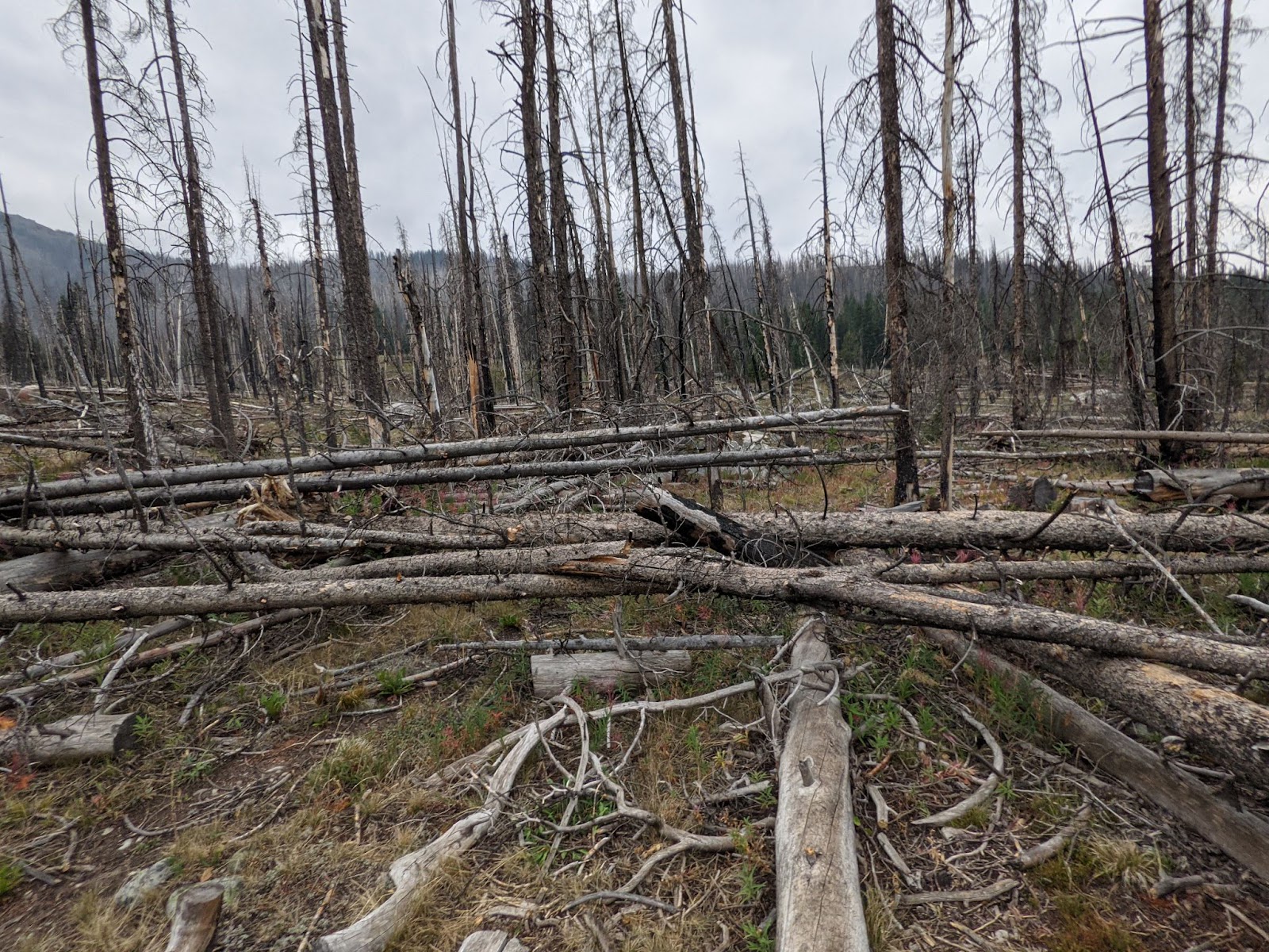
After taking all that time to get back to where I was, I hiked for two days, over downed trees and past beautiful lakes.

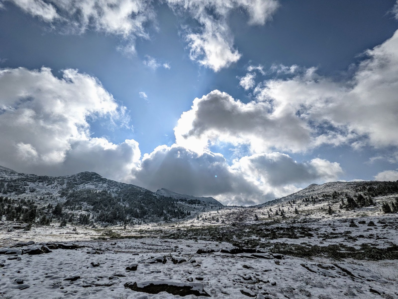
On the third day I woke up to a pervasive cloud of mist.
And the trail was going up to 10,000 feet. The rain that had been falling as a mist all morning started turning into snow.
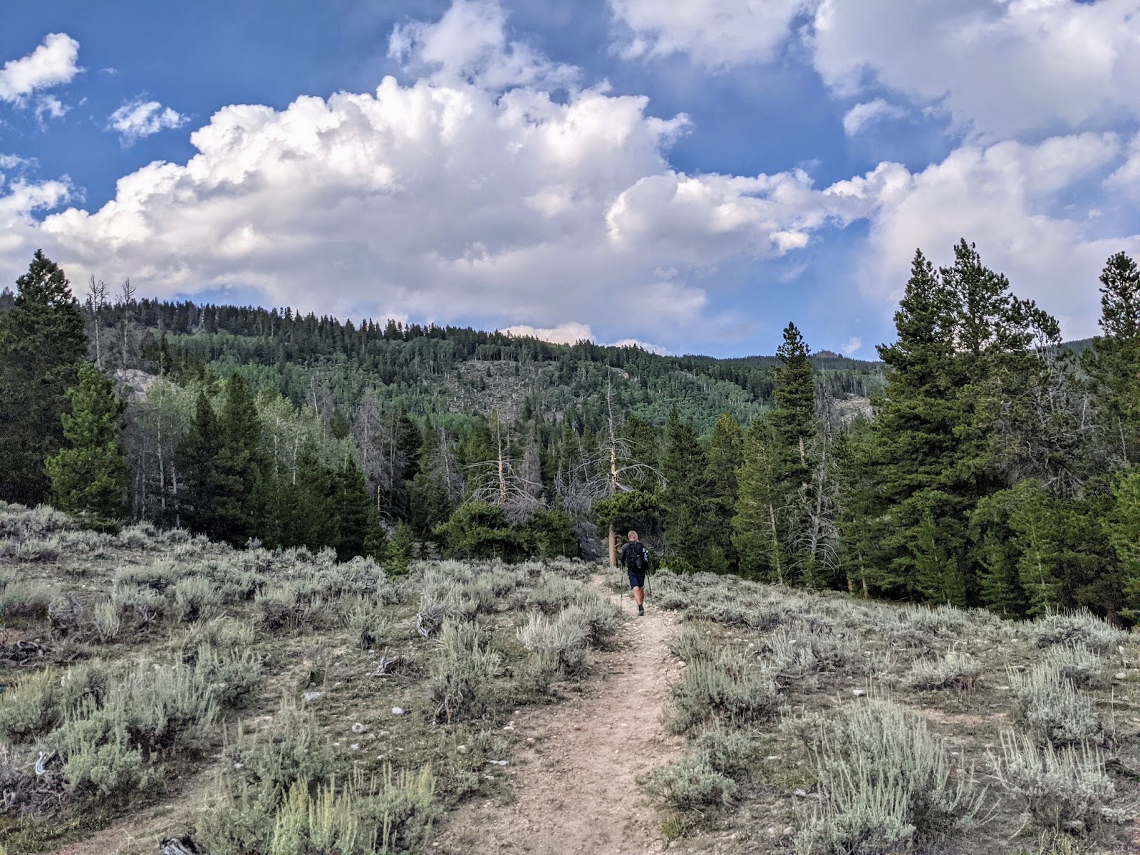
I was ready to hike after taking 10 days off from the trail. And now I was more than a little nervous about the fact that I was only halfway across Wyoming and already getting snowed on. But, I knew hiking all day in wet snow can be very dangerous when you’re sleeping in an ultralight tent with ultralight summer backpacking layers. So, I bailed off the CDT and walked a 15 mile side trail into Pinedale.
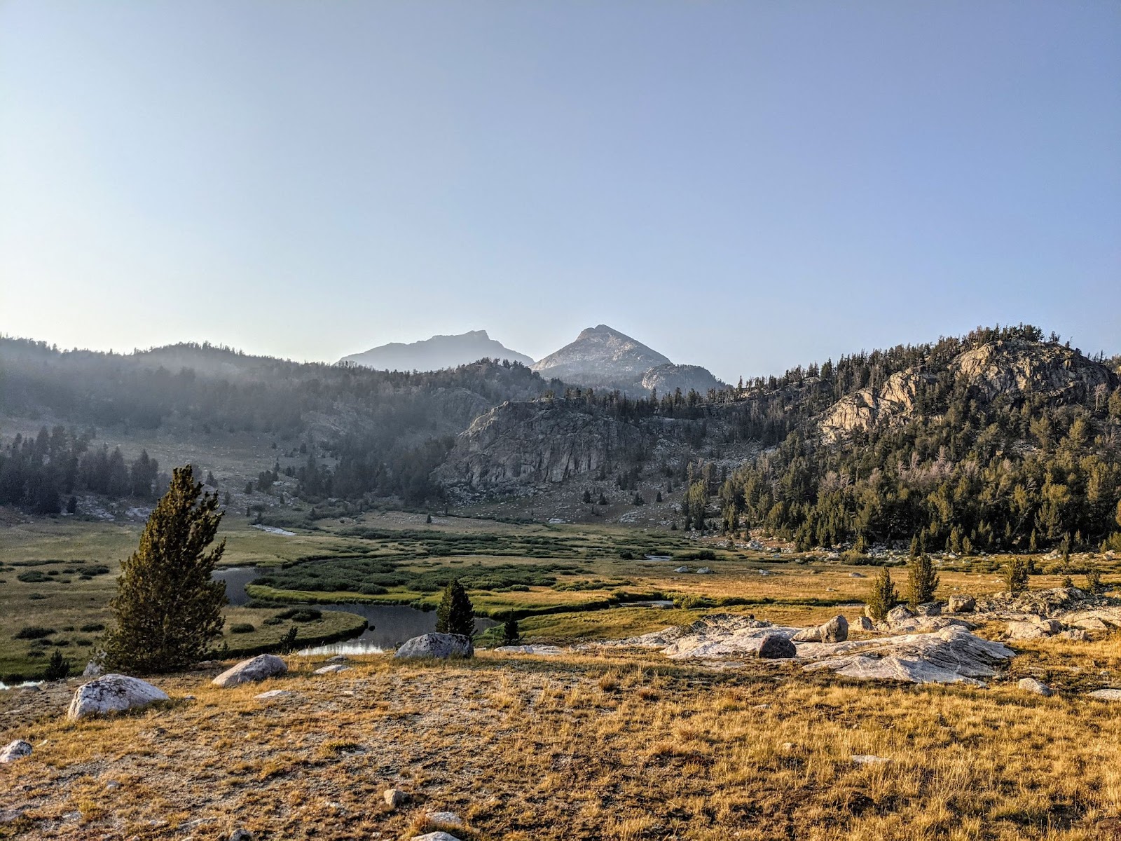
This is from a relatively nice weather moment while hiking that side trail.
After spending a full day in Pinedale waiting out this same storm system, I’m sitting in my tent again. The sky is alternating between dumping hail and snow on my tent. It started at 4 pm and it’s now 8. I already ate dinner. I guess it’s time to go to bed.
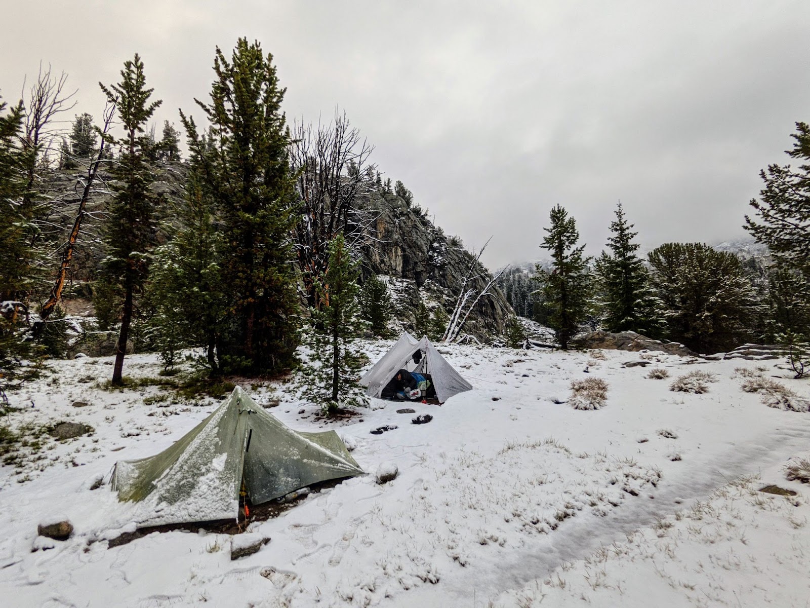
I wake up. It’s dark. There’s something heavy on my feet.
I turn on my headlamp. The snow is so heavy it has caused the corner of my tent to collapse and my feet and are buried under all that snow. It’s surprisingly warm. I pull my feet out and see that my quilt’s footbox isn’t very wet. I guess my tent’s Dyneema material is actually very waterproof.
I have to go out there–to sweep all that snow off my tent, to batten down the hatches. This snow is heavy and it’s not going to stop until the morning. I put my rain jacket and shoes on.
Okay, let’s go.
It’s definitely snowing out here, a lot. I push all the snow off my tent and check the stakes. Everything is as it should be, but the snow has caused the tent to sag. I tighten all the guylines to make the tent as tight as possible. There goes a stake.
Okay. I dig around under the snow and pull out a large rock. I reinsert the stake that popped out and place the rock on top. I might as well get some more rocks for the other stakes now.
I’m climbing back into my tent when I notice my trekking pole, which serves as my tent’s one and only tent pole, has been driven 6 inches into the ground by the weight of the snow. Well that’s why my tent was so saggy! Now I don’t have as much headroom, but I’ll be lying down anyways. Whatever. Tomorrow will be sunny.
I wake up. It’s light out. My tent has collapsed onto my feet again but it’s not snowing anymore. It looks like there could be some blue sky out there.
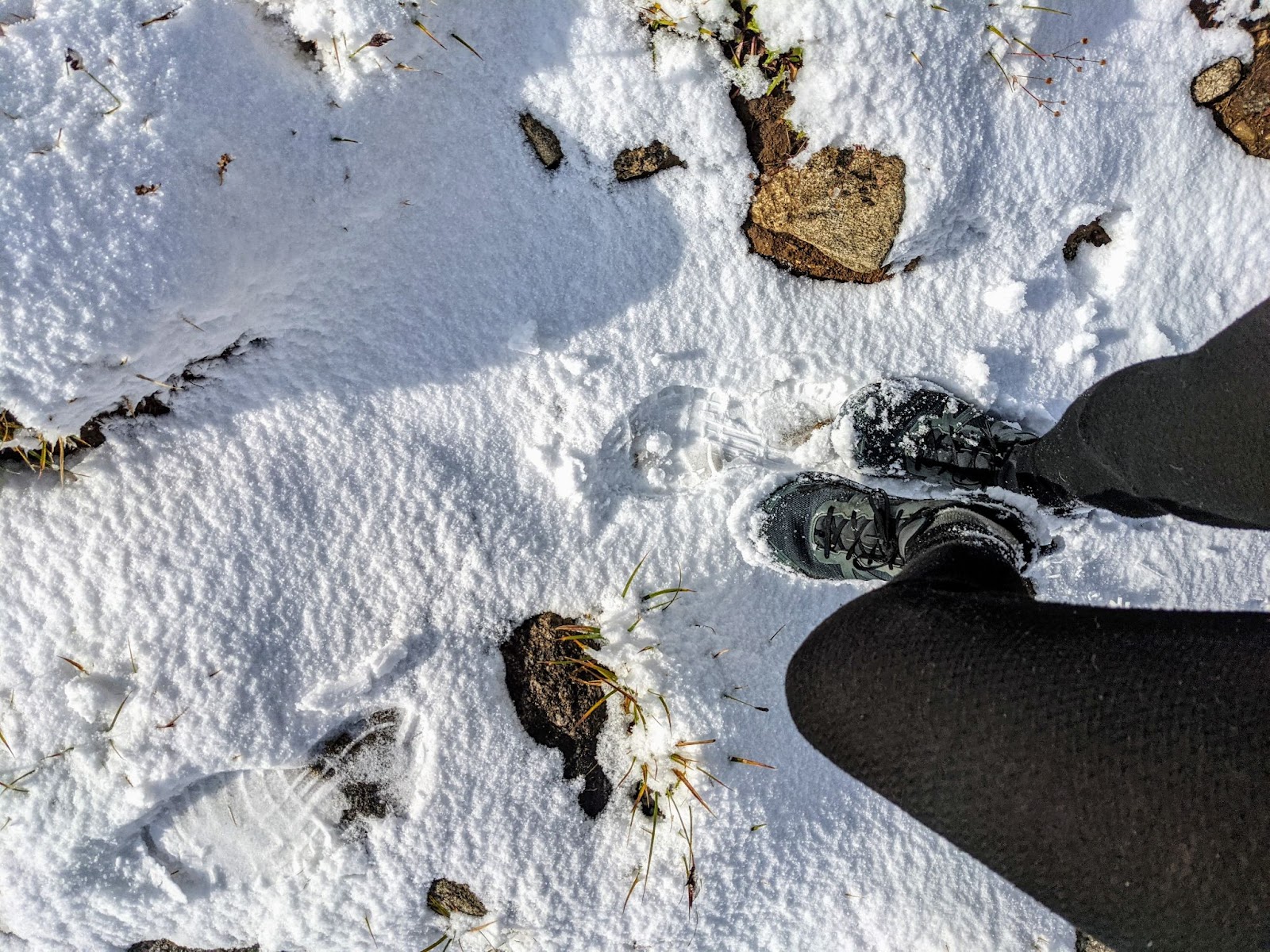
Okay, there’s not any blue sky yet but it did stop snowing. And, I’m ready for whenever the sun does come out with my “sunglasses.”
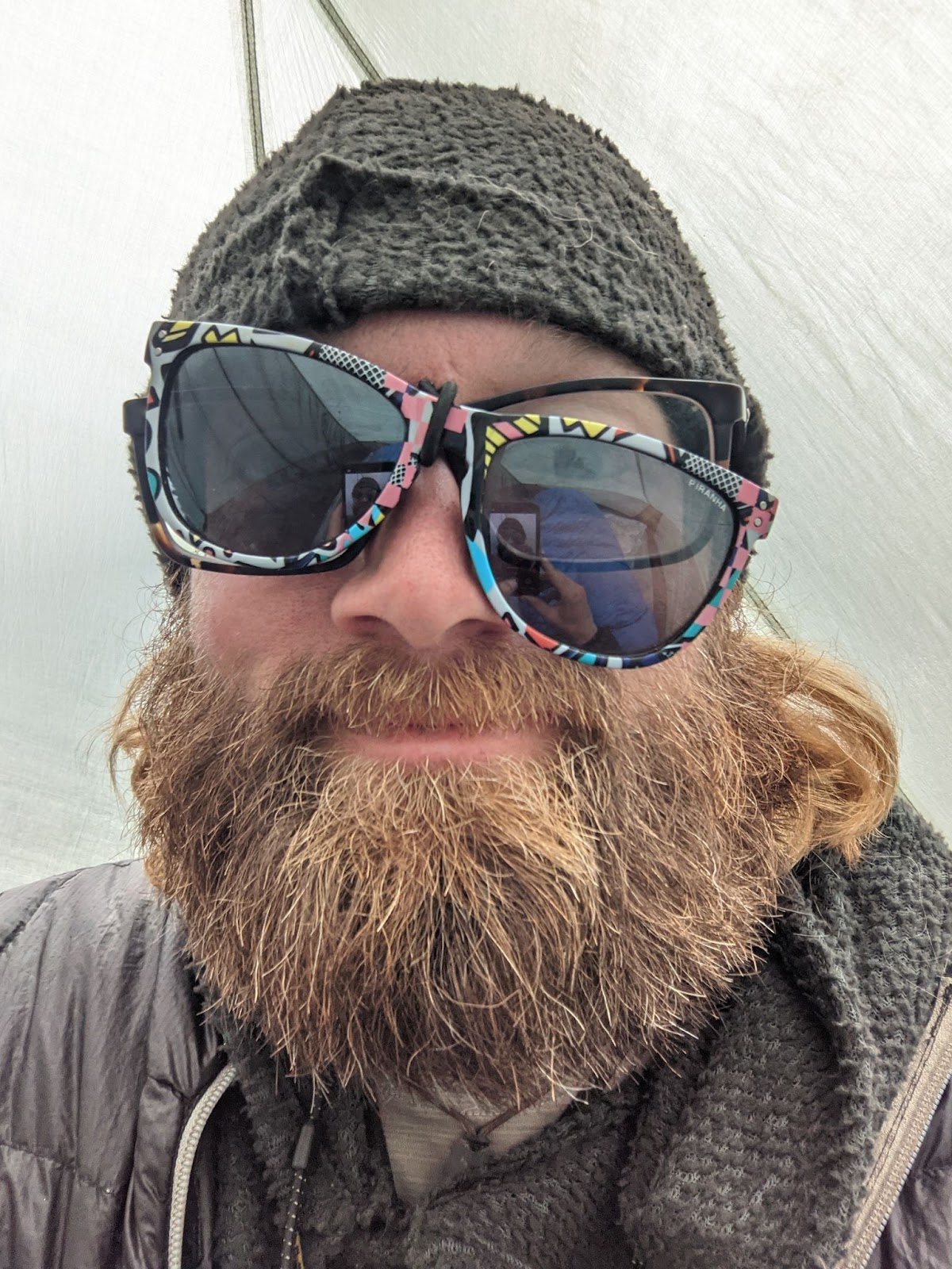
That’s right, cheap sunglasses with the arms ripped off that I can attach to my glasses. I start hiking around 8:30 and the sun comes out as I’m climbing to the top of a pass. It turns out Gorilla tape works better than shock cord for this.
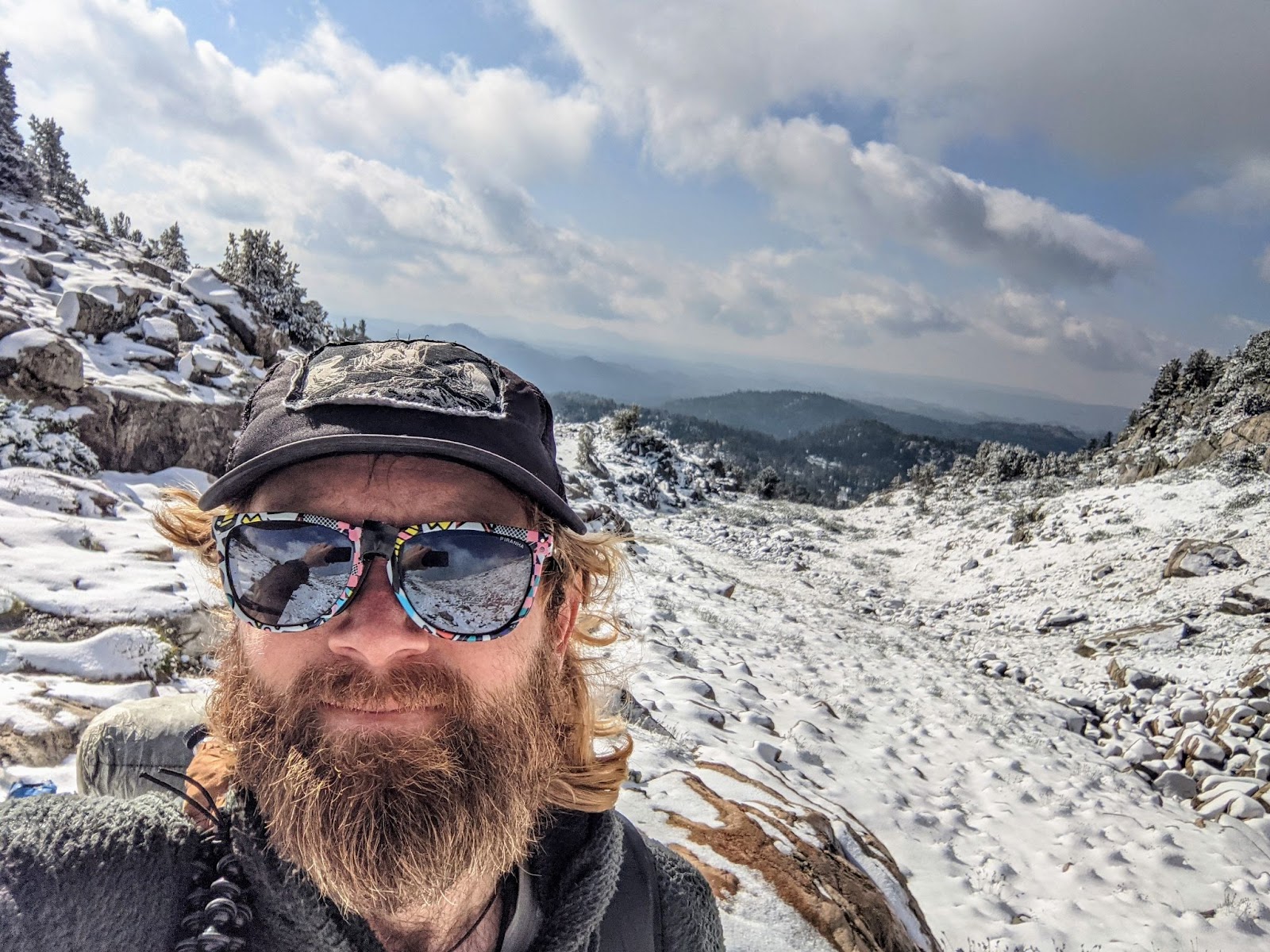
These mountains quickly became even more beautiful, covered in snow with the sun shining.
But, I’m just as excited for all the snow to melt and my shoes to dry.
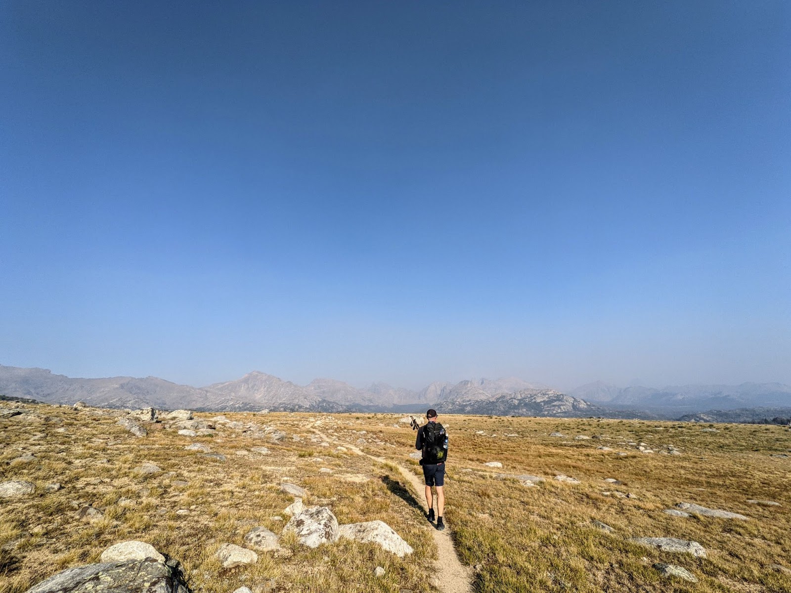
After a couple hours hiking through melting snow my feet are no longer actively getting wet. I stop to dry everything out and eat lunch. By the afternoon I’m walking across a high elevation meadow with two other hikers. The only cloud in the sky is the cloud of wildfire haze that has blown back in.
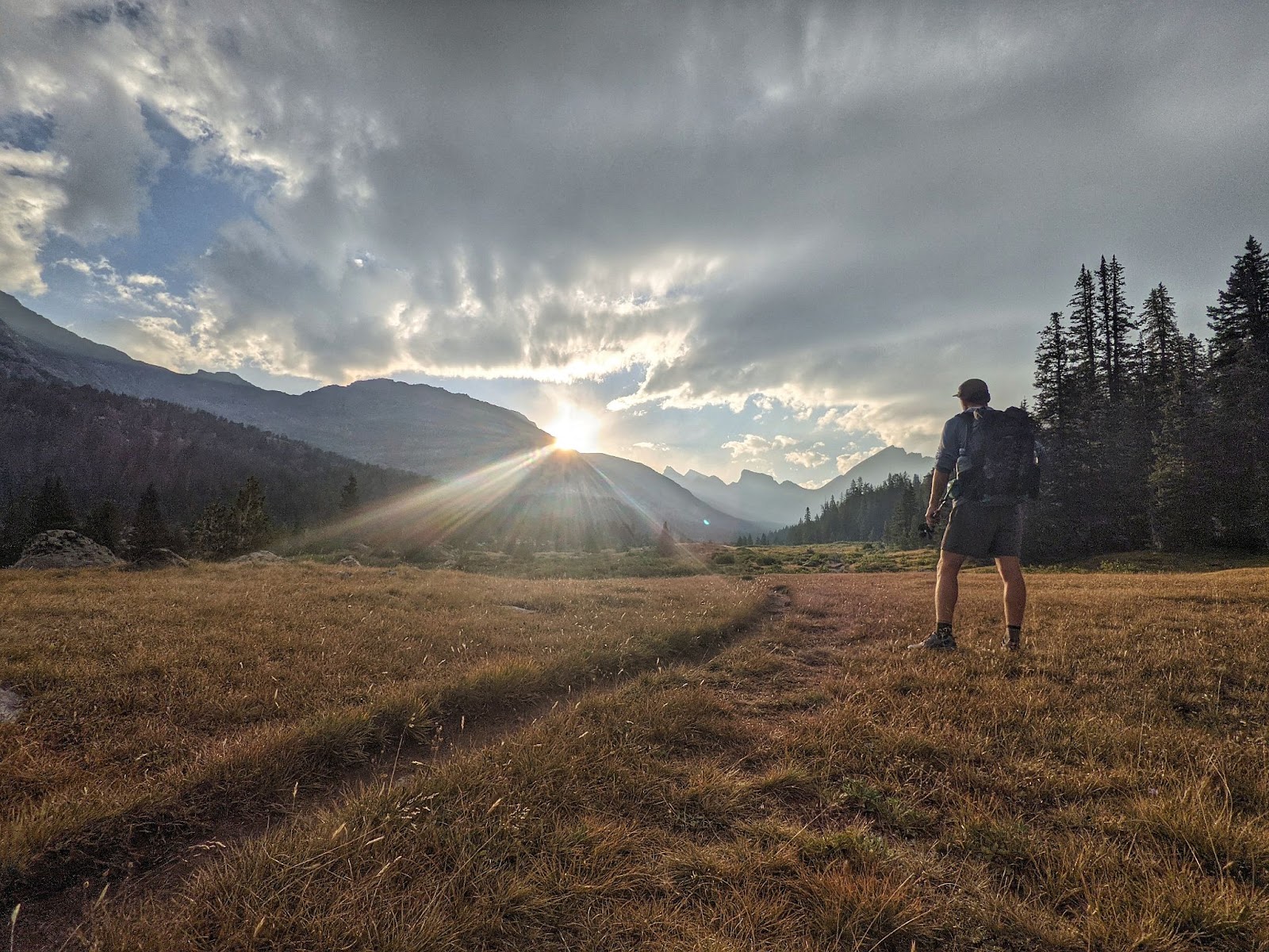
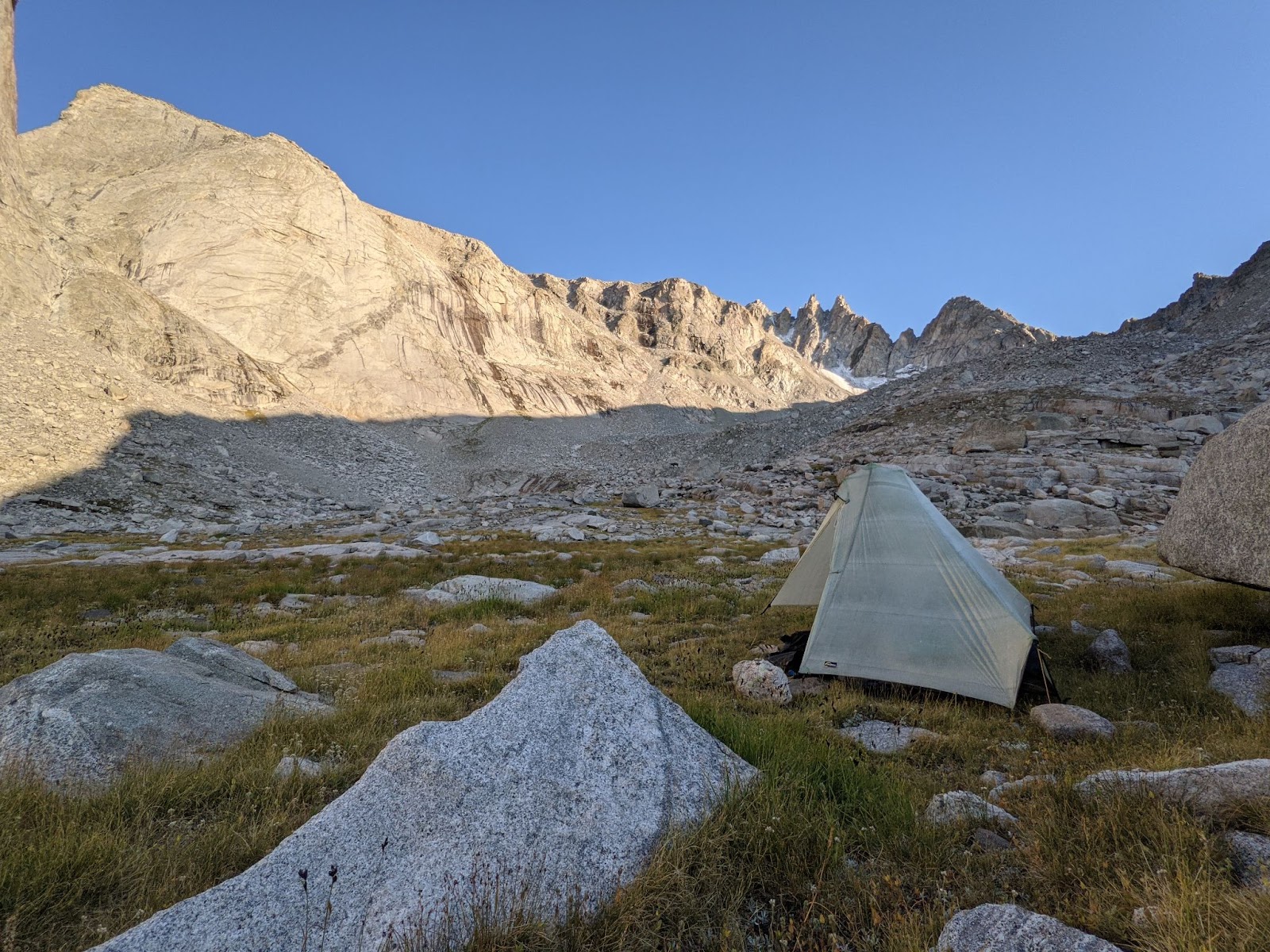
I make camp in this beautiful meadow with the other hikers, William and Sheepgoat.
That night, Sheepgoat and I make plans to take a high route out of the Winds into Lander. Because of the weather we’ve had to avoid some of the high routes up to this point. So, we decide to follow what appears to be a trail on our GPS maps. But, this trail goes over Wind River Peak, the highest point in all of the Winds.
Spoiler: it wasn’t a trail at all. Tomorrow will be the day I confirm that black dotted lines in Gaia mean it is a route. But today, I’ll go over Texas and Jackass passes.
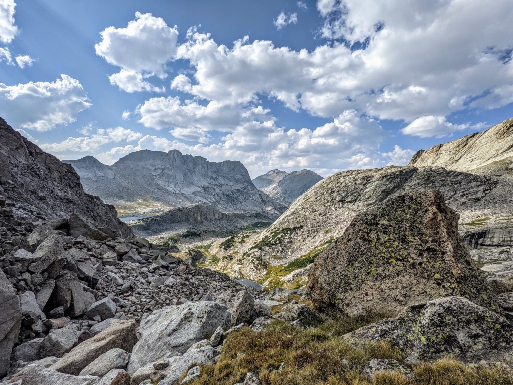
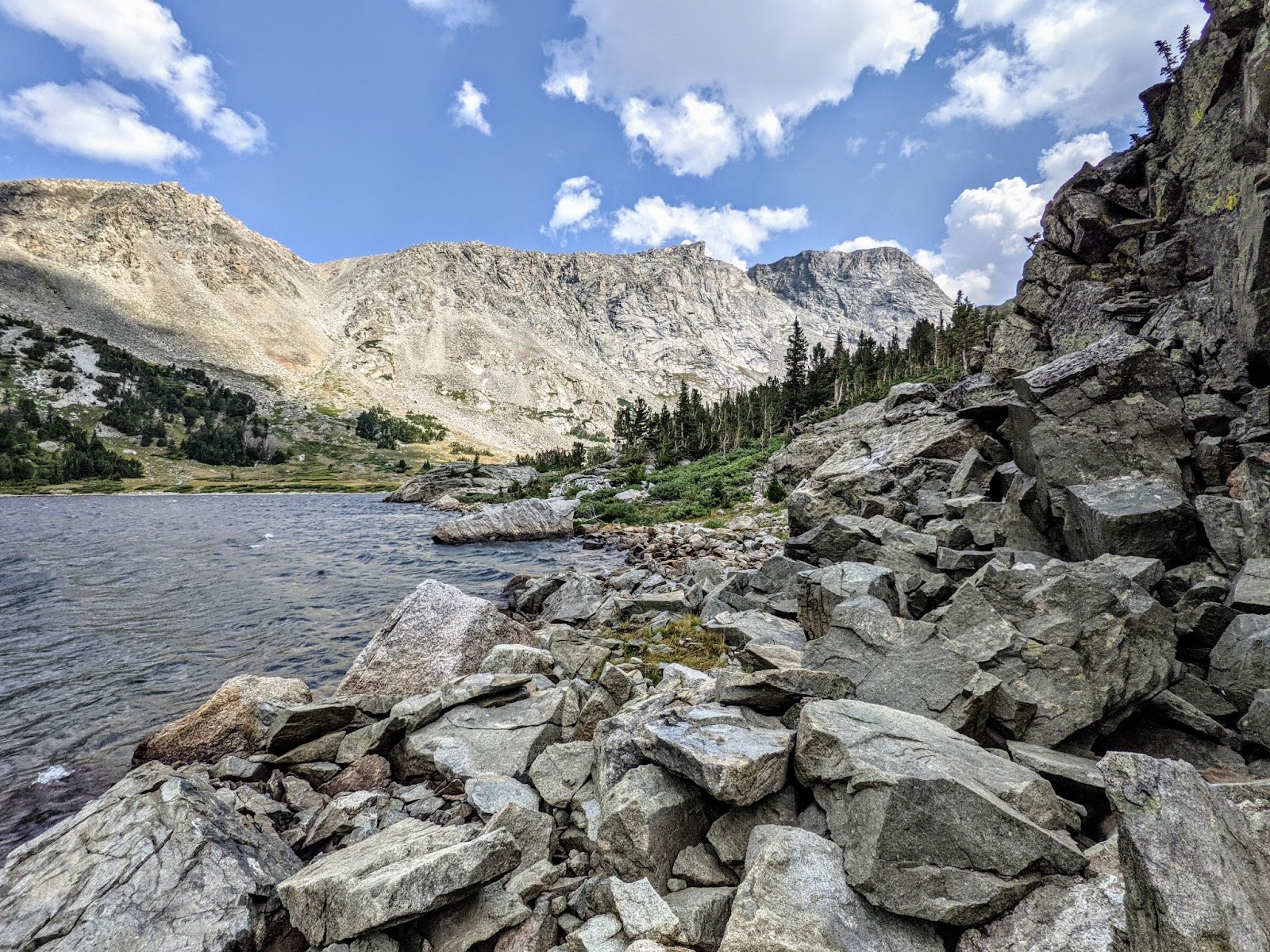
Sheepgoat and I split off from William after Jackass pass and a nice lunch by a lake. A little about Sheepgoat: he is from Denmark and is the Danish equivalent of a Navy Seal. Good thing, too, because as we leave the trail onto what becomes increasingly obvious is going to be a route things get really difficult.
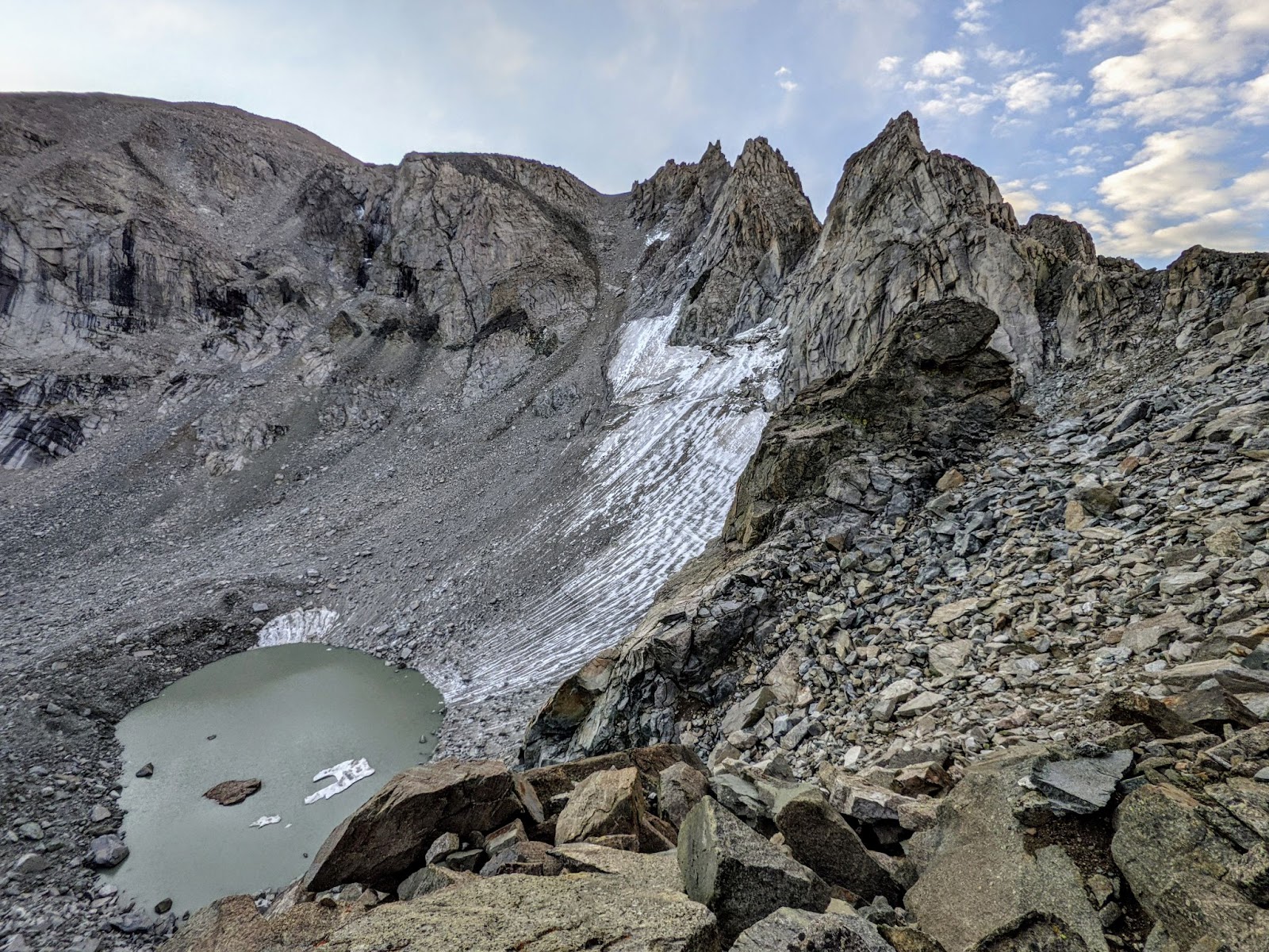
First, we cross a 3 mile boulder field that sits in between a lake and tall granite walls. The boulders were all car-sized, or bigger. At this point I’m having fun, climbing over a series of bouldering problems thinking that maybe there will be a trail on the other side of this, whenever it ends. Sheepgoat keeps insisting that there will be a trail. I’m not so sure after covering a mile of the boulder field in about 45 minutes.
Two hours and about three miles later, there is no trail but we’re past the boulder field and walking on grass. We go up a small valley with a creek flowing down the middle. We see…people? Maybe this will turn into a trail eventually.
One of the people starts moving quickly towards us. He’s running, actually. He crosses the creek without even trying to keep his feet dry and waves at me. I wave back and keep walking.
He gets a little closer and frantically yells, “Stop! I need to talk to you.”
…So I stop.
He runs across the creek again. Now he’s standing next to me.
“Do you have an Inreach?” he asks.
“…yeah, why? Are you gonna press the SOS button?” I respond.
(An Inreach is a satellite communication device that allows you to send and receive text messages in the backcountry and allows you to call for help. He should have had one of those himself, especially if going out into the mountains when it might snow.)
“No, no. I…I…just need to send a message to this search and rescue guy we were talking to yesterday.”
Great. Well it turns out this guy brought his 60-something year old father on a high route through the Wind River Range, when snow was a possibility in the forecast.
He’s frantic and doesn’t make very much sense. But I guess he was able to get a weak cell signal on top of a peak somewhere out here and tried to call for help. I was able to deduce from his ramblings that a helicopter may have tried to rescue them, but couldn’t land anywhere nearby.
“Here, just tell me what to send and I’ll type it.” I say after he sends a three word message to the search and rescue guy’s cell phone.
“No, can I just write it?” he responds.
“…sure”
“Thanks”
“Yeah, so, where exactly were you guys when it snowed?”
He just kind of points. Then he blurts out a bunch of very specific elements of the route that I’ve apparently signed up for.
“This is going to take you much longer than a day and a half,” he says when I tell him our plan.
“No it won’t because that’s all the food I have left,” I tell him.
He uses up all 15 of the messages I pay for each month just to be told by the search and rescue guy that he should walk to a nearby trailhead. This guy is freaking me out. But, he gives me a bunch of food. I tell him there’s a flat spot to camp just down the valley. He tells us we should camp by the lake at the top since that will be the last flat spot for a long time.
We head in opposite directions. I hope his dad is okay but there’s nothing I can do. They already refused my offer to help them carry the dad’s pack out. They made it this far. They’ll make it out.
I hope.
Either way, I’m more nervous than I was before after that encounter.
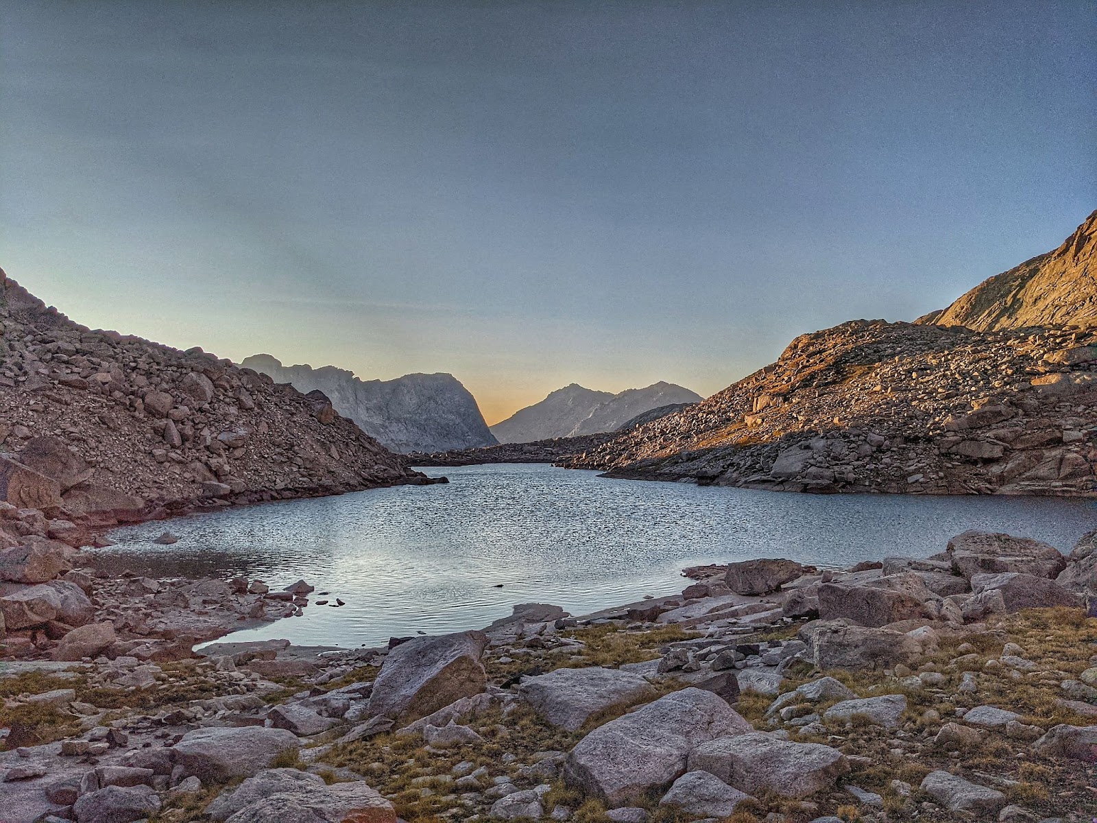
But the lake at the top is beautiful. Tomorrow we’ll have to figure out how to get on top of this ridge that surrounds it on three sides, though.
For now, I eat my dinner. That guy gave me a snickers bar, which I eat for dessert.
Thanks guy, hopefully this isn’t as hard as you made it out to be.
Hopefully you and your dad make it to that trailhead tomorrow.
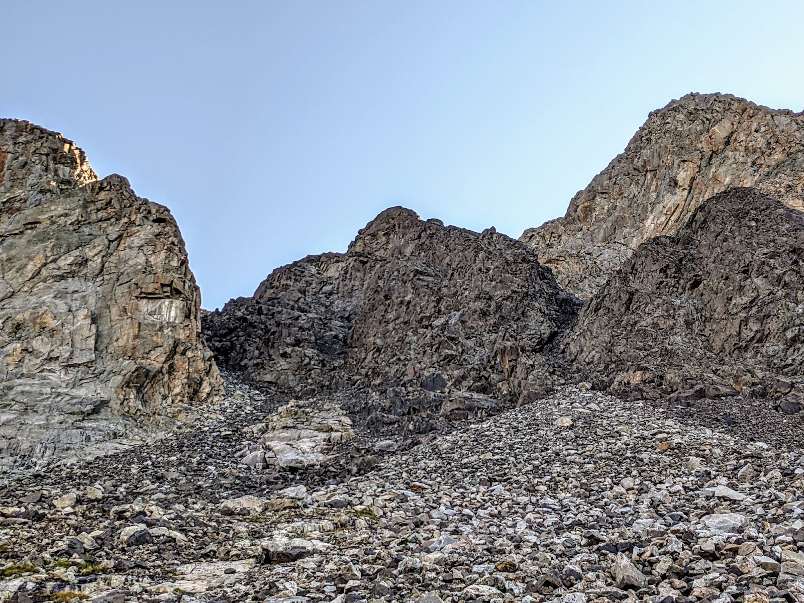
I wake up in the dark and eat the oats I soaked overnight in a talenti jar. I drink cold instant coffee and stare up at the steep slopes all around me. The dotted line we’re following seems to go across that snow field. That’s obviously not the way we’re going to go with trail runners, and no ice axes, or crampons.
So we’ll go up an area that seems less steep. It has a saddle we can get onto, too. It looks like it will be sketchy, with loose rocks all the way up, but it doesn’t look downright deadly. As the sun lights up the sky I walk closer to where we’ll start climbing. It doesn’t even look that steep from here.
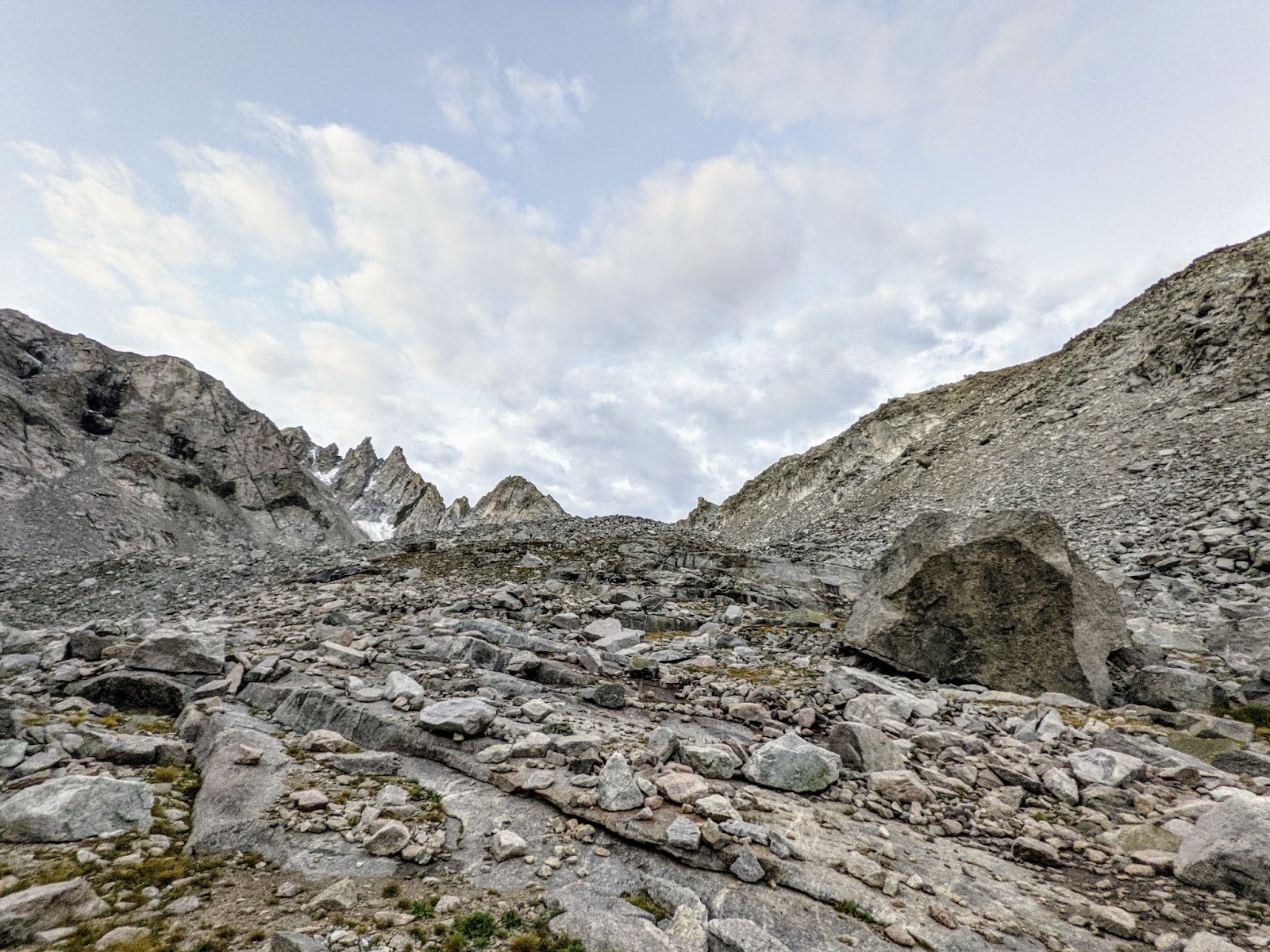
But as we begin to climb I find that it is steep. It’s so steep that we have to take turns climbing so as to not bury whoever is lower in falling rock. This is some sketchy mountaineering.
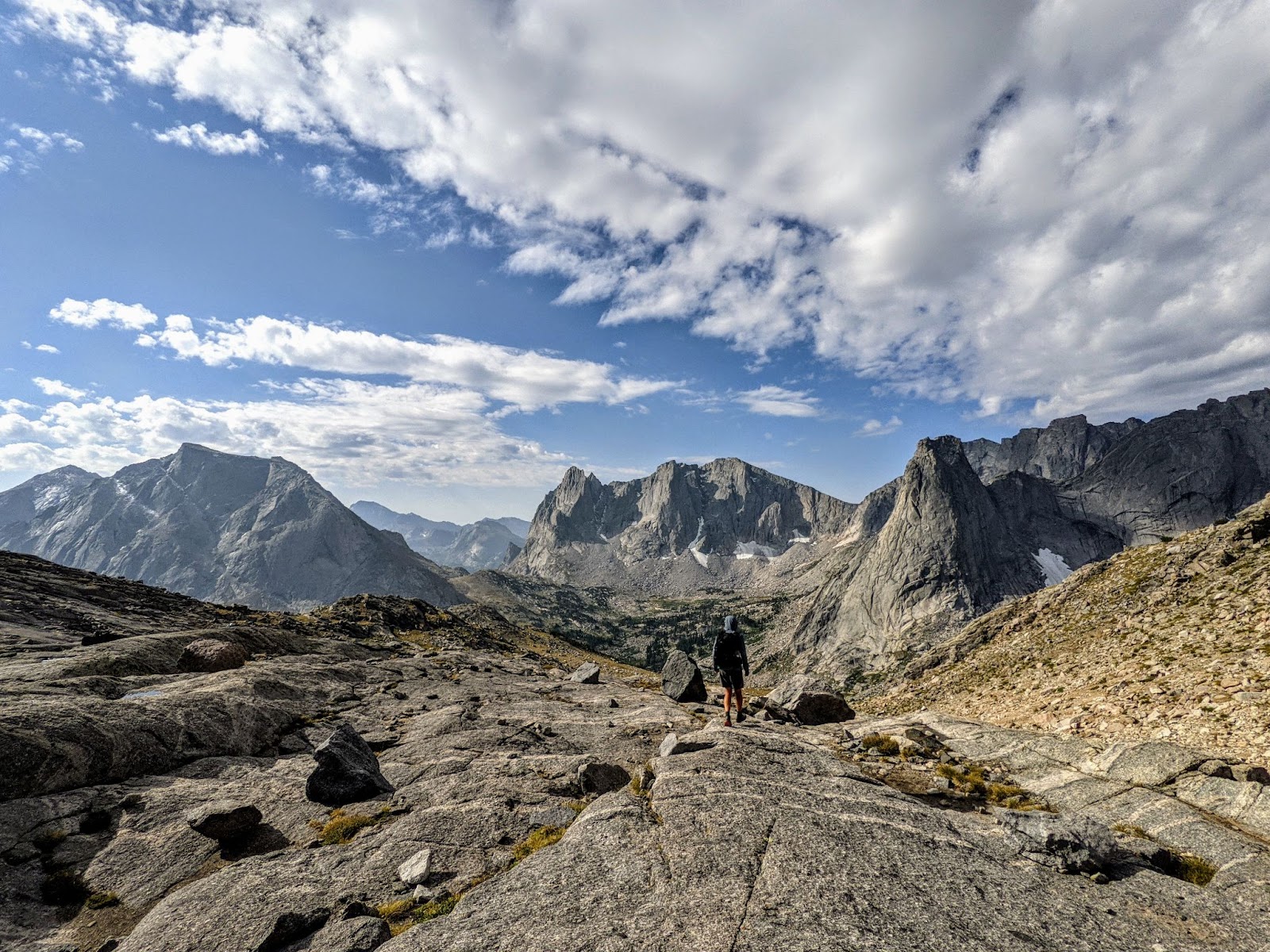
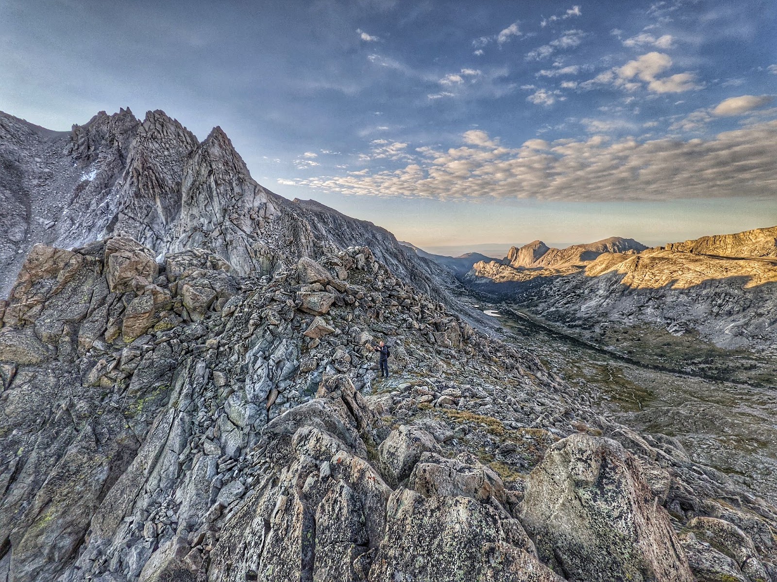
We get to the top and the views are worth the climb. I catch my breath while looking around.
Sheepgoat, looking a little sheepish, says, “It’s a good thing my wife and kids don’t know I’m doing this.”
I laugh and respond, “It’s a good thing you’re in better shape than that dad from yesterday.”
“…yeah.”
But, the ridge we’d hoped to walk doesn’t seem traversable. Well it’s probably doable with ropes, but we don’t have ropes.
So we climb all the way down, into the next valley. We walk down that valley, looking for a spot that looks like we can climb back over the same ridge we had just climbed up and then down. We find a spot and climb to the top.
When I’m almost at the top, I start to really wonder if we’ll be able to find a spot to climb down on the other side. Fortunately there is one.
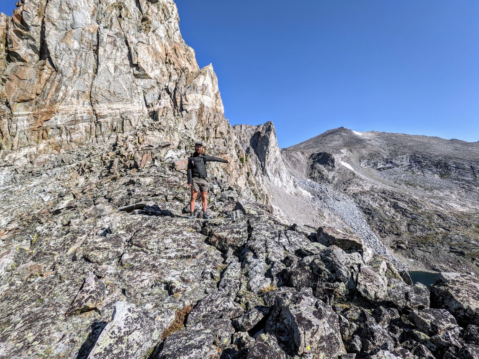
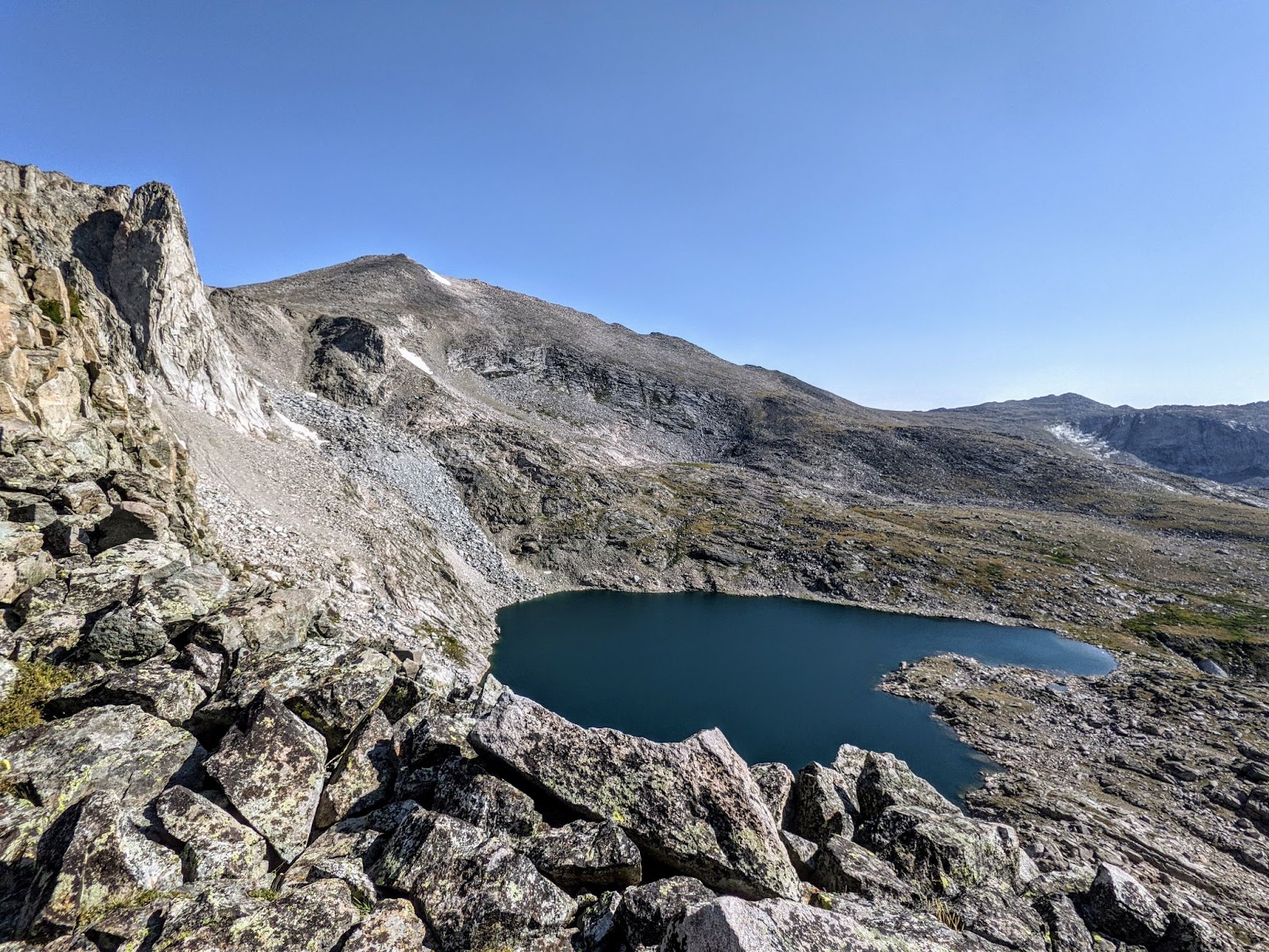
Several hours later, we’re sitting at the base of Wind River Peak eating lunch near a lake. From this side, the tallest peak in the Winds is just a smooth, grassy hill. We had already been on the steeper, rockier side.
Alright!
We cross a valley and climb up to a saddle and are greeted with a cliff. There’s clearly some more information we should have had before taking this route, but we find our way down, slowly making our way north and east when we want to end up almost directly south of where we are.
Then we’re on a trail, finally. Wow, I can walk fast when I’m not walking over screen fields.
We have covered something like 6 miles in 6 hours. I estimate we climbed about 6,000 feet over that distance, too. Well, it’s only 15 miles to the Sinks Canyon trailhead in Lander.
It feels great to just zone out and hike all afternoon after the mentally strenuous morning spent constantly looking for the best route for the next 50 feet of climbing. By 7 o’clock that evening we’re catching a ride to downtown Lander with some people out for a day hike.
Dinner from the Safeway in town was delicious. I should have got a double serving of chicken tenders.
And, it turns out we could hike that route in a day and a half. I guess that guy underestimated what kind of shape we’re in.

One thought on “CDT Part 9–Wind River Range”