
Yellowstone National Park is big. Like, really big. But, it’s not just big geographically. It just is big. Standing on a ridge looking into the park, I could just feel that Yellowstone was special–big, wild, untouched. We hiked into the park from the north side, skirting the edge of the park that first day. ItContinue reading “CDT Part 7–Yellowstone”
Category Archives: Uncategorized
CDT Part 6: Baby Carrots to Big Sky

This thru-hike I’m trying to eat as healthy as possible. Granted, when you’re carrying everything on your back, and filling it with food from small grocery stores and gas stations, that might not be all that healthy. But, I’m trying. One of the nice things about the Big Sky Alternate is that there are aContinue reading “CDT Part 6: Baby Carrots to Big Sky”
CDT part 5–mostly photos
I’m currently in Ennis, Montana. This is about 100 miles into the Big Sky alternate. A major plus about the Big Sky Alternate is that you end up hiking through all of Yellowstone. I’ll be getting to Yellowstone much sooner, too. Like, I’ll be there in less than a week now. There’s been a decentContinue reading “CDT part 5–mostly photos”
CDT Part 4–Big Sky Super Butte Alternate
Here is a GPX file of the Big Sky Super Butte Alternate, in case you need it. The Trail Creek Fire is still burning, and growing. And, the CDT is closed in that area to avoid the fire. So, I’ll be hiking one of the biggest alternates on the CDT, the Big Sky Super ButteContinue reading “CDT Part 4–Big Sky Super Butte Alternate”
CDT Part 3–A Hole In My Leg

100 miles into the Bob Marshall Wildnerness, a ranch will bring boxes mailed to the owners at their house 50 miles away. I mailed them a box. They charge $30 to bring the box to their ranch. It’s worth it. So, on the morning of the fifth day in “the Bob” I walked the 3Continue reading “CDT Part 3–A Hole In My Leg”
CDT Part 2–Bob Marshall and Scapegoat Wildernesses

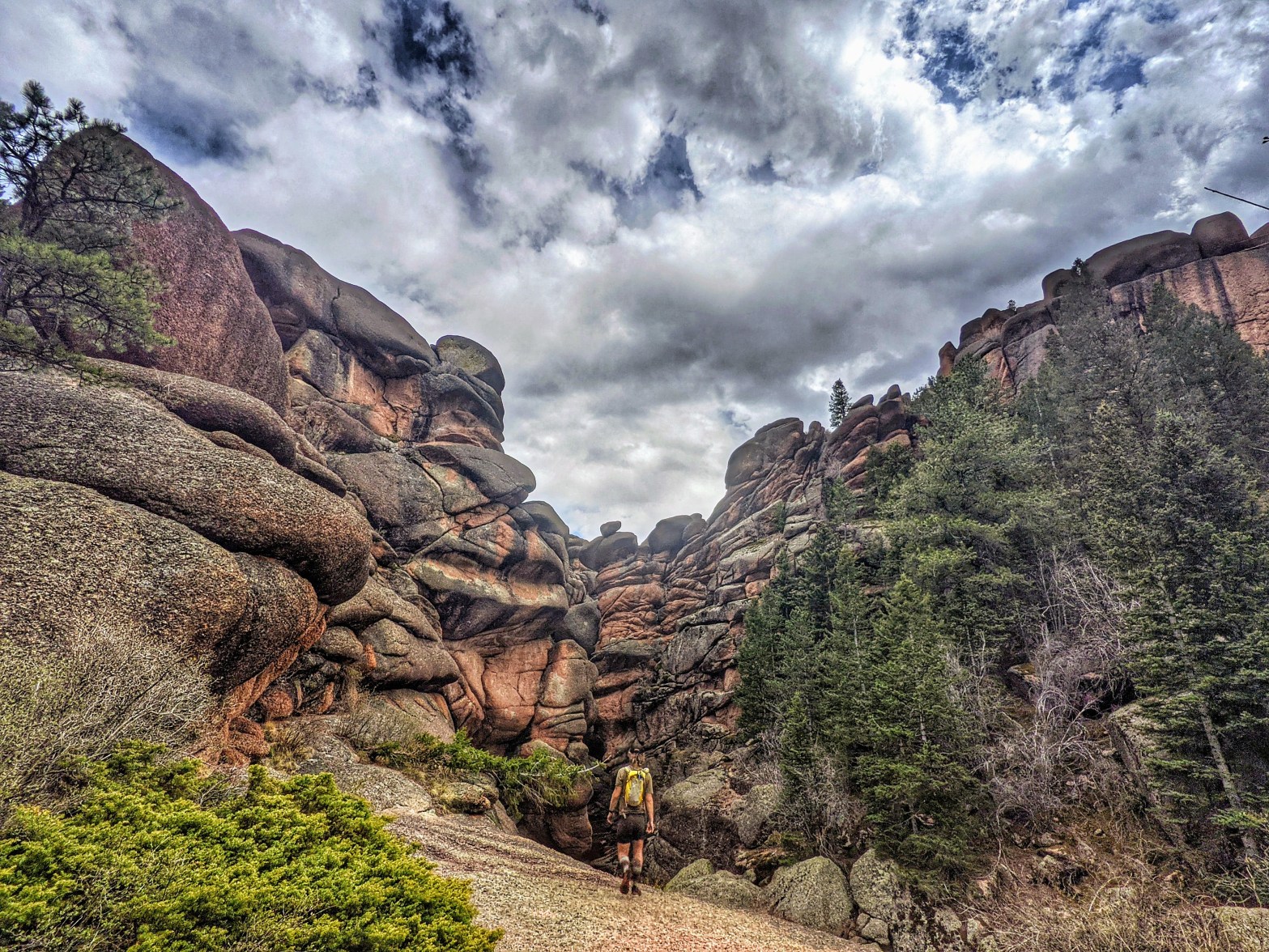
Immediately after leaving GNP the CDT begins to feel more wild. Maybe it was all in my head, maybe it really was. This is where I start to really feel like I’m on a thru-hike. Me, Ninja, and Wayward got a ride to the trailhead from East Glacier Village. We were out at the highwayContinue reading “CDT Part 2–Bob Marshall and Scapegoat Wildernesses”
CDT Part 1–Glacier National Park
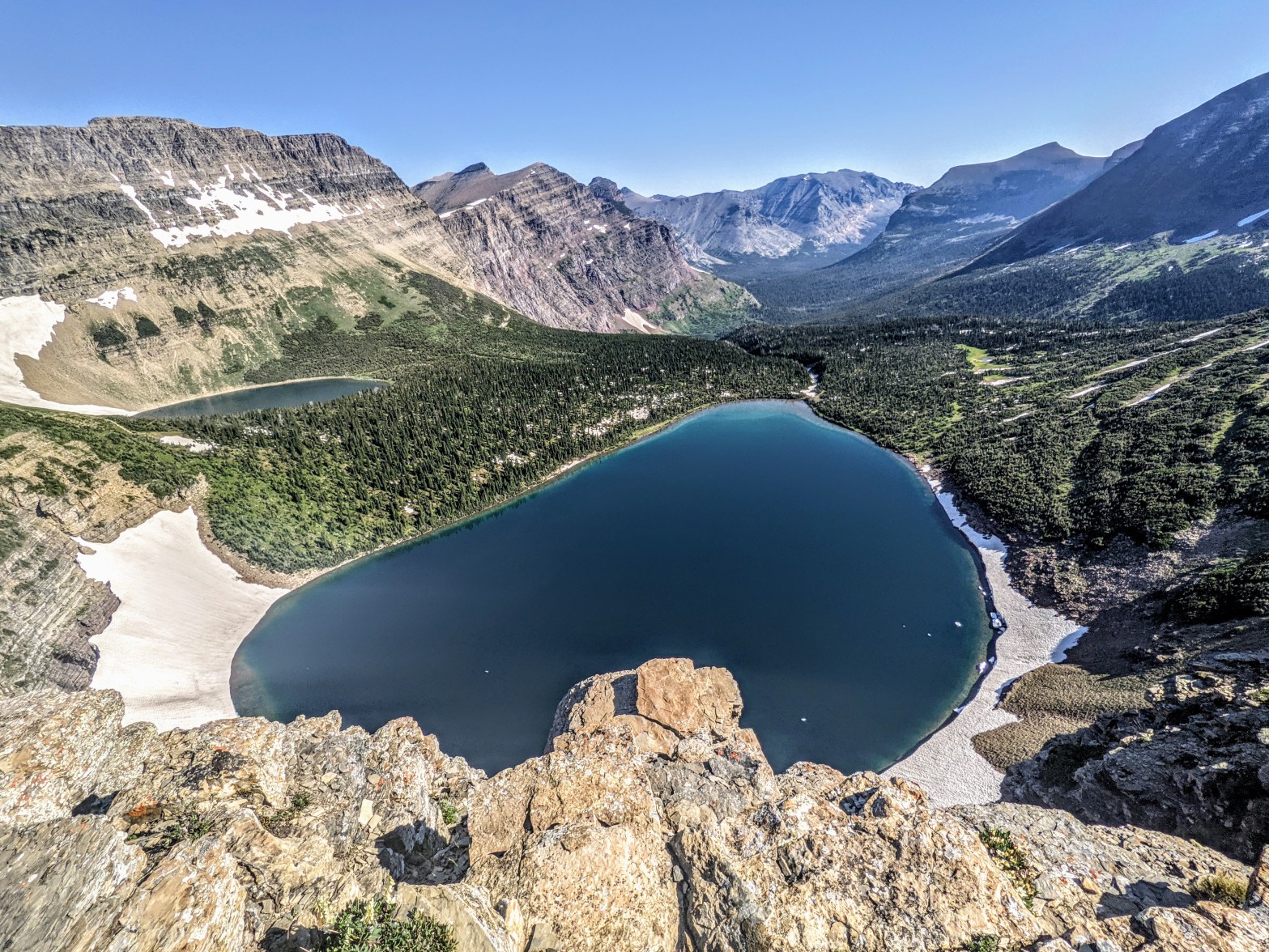
Two weeks ago I flew to Glacier Park International Airport in Kalispell, Montana. Now, I’m sitting outside a motel room in Lincoln, Montana. I’m almost 300 miles away from the northernmost terminus of the Continental Divide Trail. But, I didn’t actually start at the northern terminus. It was too busy to start there. And nowContinue reading “CDT Part 1–Glacier National Park”
Thru-hiking and Life

A story from the beginning of my Pacific Crest Trail Southbound hike in June of 2019.
Getting to the northern terminus of the Continental Divide Trail
I’ve booked a flight to the Kalispell airport. And, I’m not planning how I’m getting to the Chief Mountain border crossing, where I’ll start the CDT. I’ll be figuring everything else out as I go.
Why I’m Hiking the CDT Southbound

The CDT mirrors the PCT in many ways. It’s on the same continent, so why wouldn’t it? The highest mountains are about 800 miles north of the Mexico border. And, the coldest, wettest part of a thru-hike is near the Canadian border, especially in late summer and fall. I’ll skip the cold and wet if I can. So, southbound it is!
